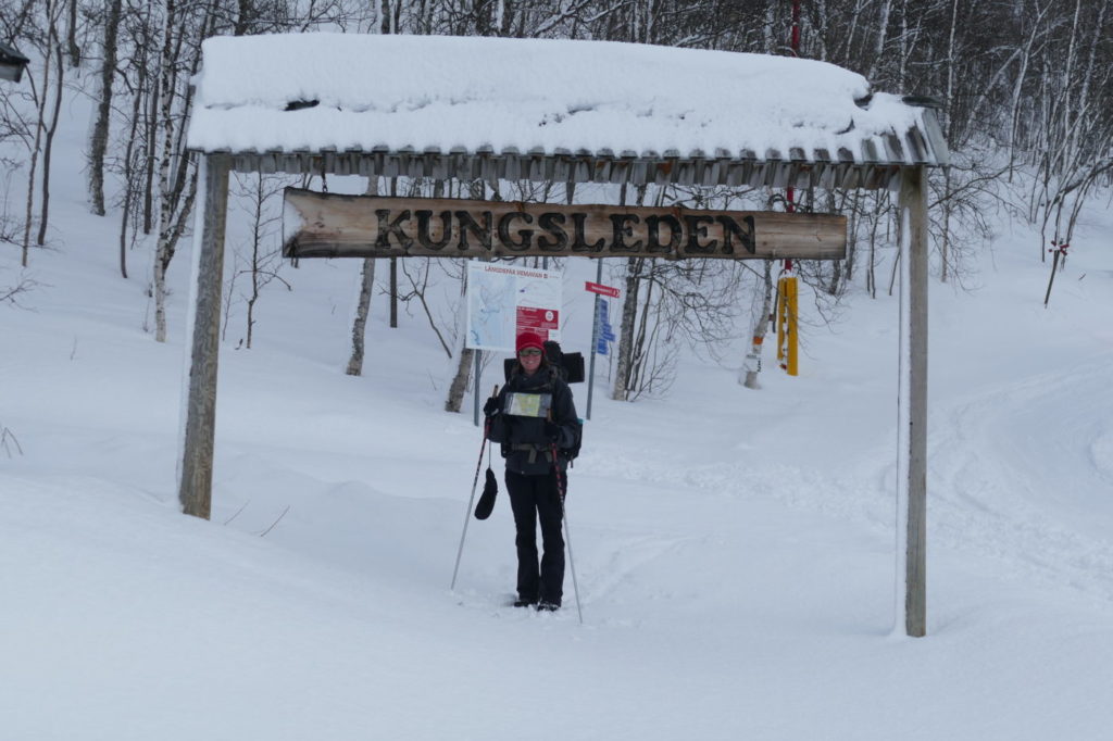
This is a brief guide for those that want to tackle the famous Kungsleden in winter. On skis, of course.

Introduction
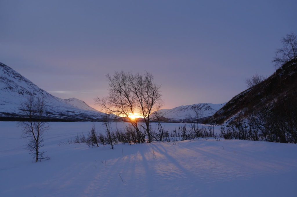
Hiking along the Kungsleden, the Swedish Royal Trail as it is called in English, has become increasingly popular. There exists a multitude of guidebooks as well as online information for this hike. However, doing the same stretch on skis in wintertime is still much more of a solitary experience. As far as we know, there is no guidebook available for the Kungsleden in winter. To close this gap a tiny bit, we have gathered some information that we learnt during our trip in 2018.
Basic facts
We completed the trail in March and April 2018, skiing south to north from Hemavan to Abisko. (We took a detour to Kebnekaise mountain station to climb the highest mountain in Sweden. This detour is excluded in this description.)
Total length: 481 km
Number of days: 32 (including 4 rest days)
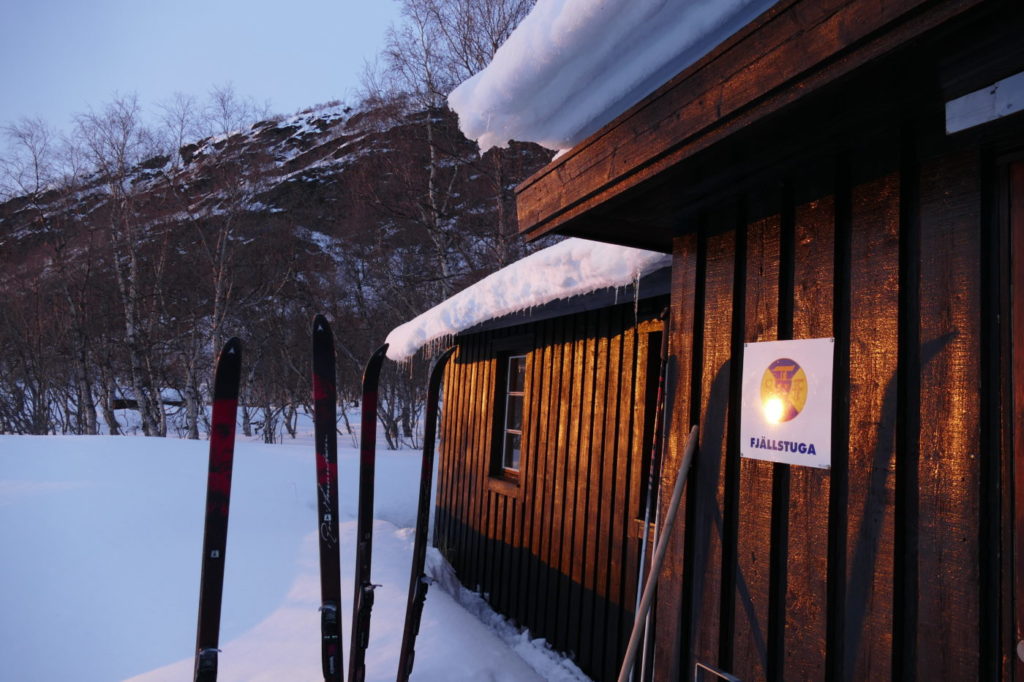
Nights slept in STF huts or mountain stations: 18
Nights slept in our tent: 7
Nights slept in other accommodations: 6
32 days is not particularly fast, proficient skiers can certainly do this much faster. However, it is a great luxury to have time on such a trip and enjoy the scenery, the huts, the breaks. Don’t be too ambitious! 😉
Also, it is certainly possible to sleep much more nights outdoors. That was originally our plan but we discovered that we absolutely loved the STF huts in wintertime: the saunas, the people, the atmosphere, the warmth.
A brief word of caution
Skiing the Kungsleden in wintertime is much more of a challenge than hiking it in summer.
- You need a lot more specialized equipment and
- will have to carry a heavier load than during summer,
- you need to know how to ski (unless you want to use snowshoes instead),
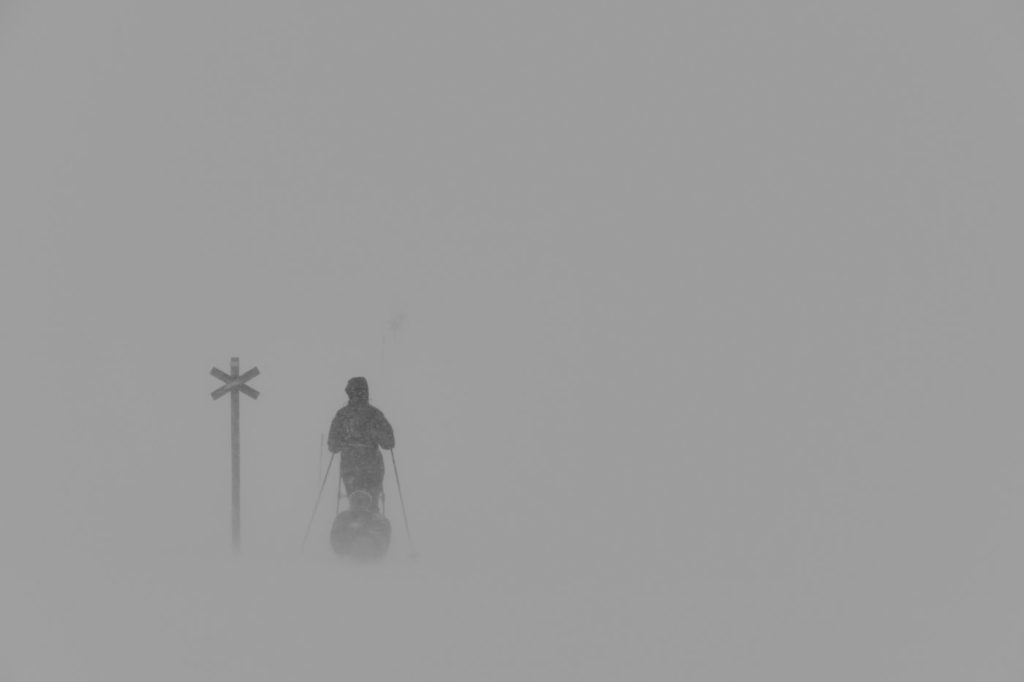
- the cold and winds can be pretty demanding,
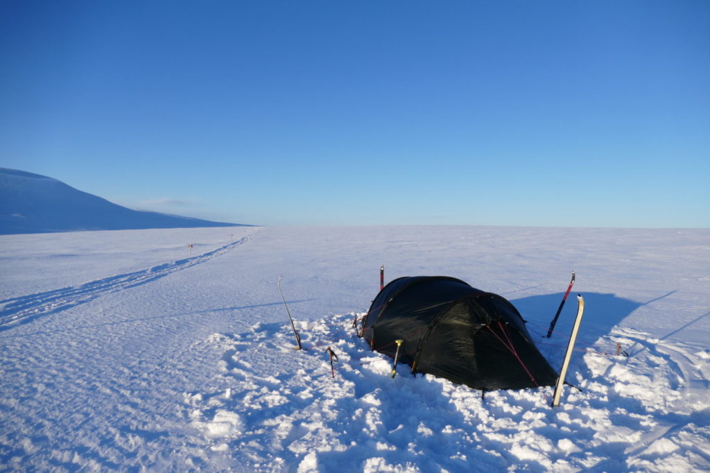
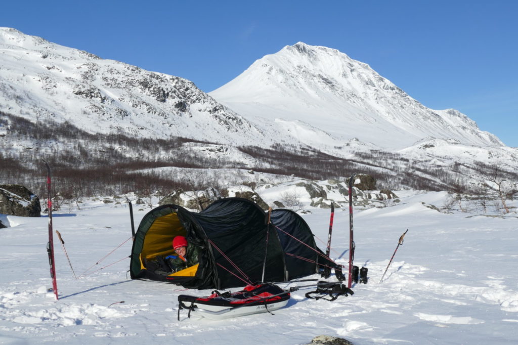
- sleeping in a tent, which is necessary in some parts, is much more challenging in winter than in summer,
- you should know how to survive in the cold in case of an emergency situation,
- getting water and preparing warm food is also more complicated and time consuming.
- In addition, there are a few parts of the trail where no official winter trail exists, so one needs to find alternatives to the summer trail.
- Please go well prepared.
That being said, it has been an amazing experience for us and the extra effort was definitely worth it!
Resupplies and equipment
We had one resupply parcel prepared in advance and sent it to Kyrkans fjällgård in Jäkkvik (after contacting them, of course). We furthermore bought a bit of food in mountain stations and STF huts (STF huts and mountains stations generally have a small store). Now, looking back, it would have been more convenient (and cheaper) to send two parcels – maybe one to Jäkkvik, one to Saltoluokta.
We have used Outdoorkartan maps 1:75,000, sheets 1 to 6.
We have a detailed gear list – but only in German. Google Translate might help.
Route
In the following we describe our route along the Kungsleden. All distances are estimates based on maps and signposts.
Hemavan to Ammarnäs
Length: 85km (6 days for us)
Possible accommodations: many hostels and hotels in Hemavan, 5 STF huts along the way, several possibilities in Ammarnäs (we stayed in Ammarnäs Wärdshus)
- Hemavan
- Getting there: by regional bus service, for instance from Storuman or Umeå
- Supplies: large ICA store right opposite the bus stop
- Accommodation: several possibilities, including the STF mountain station
- Day 1
- Hemavan bus stop to Viterskalet (STF hut)
- 13 km
- You can skip the first km or so and the first ascent by taking one of the ski lifts. But then of course you will also miss the official starting point of the Kungsleden, which is located right next to the Naturum nature centre.
- Day 2
- Viterskalet to Syter (STF hut)
- 12 km
- Raststuga about half way (shelter for short breaks and emergency situations)
- Day 3
- Syter to Tärnasjöstugorna (STF hut)
- 14 km
- Sauna at Tärnasjöstugorna
- Day 4
- Tärnasjöstugorna to Serve (STF hut)
- 19 km
- We chose to ski via the lake and along a scooter trail in order to avoid deep snow, this makes the route a bit longer. The direct route through the woods is 4km shorter.
- Day 5
- Serve to Aigert (STF hut)
- 19 km
- Sauna at Aigertstugan
- Alternatively, you can ski directly to Ammarnäs via the Tjulträsket-lake – approx. 24 km (we have not done this)
- Day 6
- Aigert to Ammarnäs
- 8 km
- Take the „tillfälligt led“ that leads from the hut to a winter path
- Ammarnäs
- We took a rest day here
- Supplies: Ammarnäs Livs, a small supermarket – right in the middle of the village
- Accommodation: Ammarnäs fjällgård or Ammarnäs Wärdshus (cheaper)
Ammarnäs to Jäkkvik
79 km (5 days for us)
Possible accommodations: one hut run by Länsstyrelsen Norrbotten (Pieljekaisestugan), private accommodations in Adolfström and Jäkkvik. There are no STF huts along the way.
- Day 1
- Ammarnäs to somewhere near the lake Lisvuojávrrie (tent)
- 19 km
- We decided not to follow the summer trail but chose an alternative route, closer to the route of the old Kungsleden that you might find on older maps for two reasons: 1) part of the trail in only a summertrail 2) the trail takes quite a detour and climbs up 500 m beore it goes down to the Vindelälven-valley and then goes up on the other side. This meant that we skipped staying overnight in Rävfallet (you would fetch the key in the store in Ammarnäs).
- We followed the Vindelälven on a scooter trail up to Höbäcken and then started to climb Björkfjället towards a „renslakteri“ (a temporary reindeer slaughterhouse). We rejoined the Kungsleden after the lake Dávtájávrrie and camped shortly after that.
- Day 2
- Lake Lisvuojávrrie to Sjnjultje shelter (raststuga)
- 16 km
- On older maps or in older guides, this shelter might be referred to as a „real“ hut. This hut however burnt down and was replaced by a shelter that is meant for shorter breaks and as emergency accommodation.
- We camped right next to the shelter and enjoyed being able to eat and relax indoors.
- Day 3
- Sjnjultje to Adolfström
- 21 km
- We stayed in a small hut in Johanssons stugby (holiday huts)
- There is a small old-fashioned store (Adolfström Handelsbod) with a surprisingly good selection of „outdoor food“ and all sorts of souvenirs. You can also get coffee and cake there and this is where you fetch the key for Pieljekaisestugan.
- Day 4
- Adolfström to Pieljekaisestugan (Länsstyrelsen Norrbotten)
- 14 km
- The main room of the hut with kitchen, stove and tables is open but you need to rent a key to be able to use the separate bedroom that has 4 bunks.
- Scooters are not allowed in Pieljekaise national park, so don‘t expect any scooter trails there.
- Day 5
- Pieljekaisestugan to Jäkkvik
- 9 km
- We took a rest day here.
- Supplies: Handlar’n Jäkkvik, small store with a quite good selection of „outdoor food“ and some useful outdoor gear (e.g. gas cartridges)
- Accommodation: Kyrkans fjällgård (a kind of youth hostel with some separate huts that is run by the Swedish church), Jäkkvik fjällcenter next to the ski lift
Jäkkvik to Kvikkjokk
100 km (5 days for us)
Possible accommodations: private accommodation in Vuonatjviken, STF shelter at Tsielekjåkkå, STF mountain station in Kvikkjokk
- Day 1
- Jäkkvik to shortly after Vuonatjviken (tent)
- 26 km
- There are holiday huts that can be rented as well as a restaurant in Vuonatvijken.
- Day 2
- Shortly after Vuonatjviken to Räjssi, very close to the polar circle (tent)
- 15 km
- The trail is not as well marked (the red crosses are set up quite irregularly) in this section but the scooter trail was very obvious.
- Day 3
- Räjssi to shortly after Västerfjäll (tent)
- 23 km
- The trail is not as well marked (the red crosses are set up quite irregularly) in this section but the scooter trail was very obvious.
- Day 4
- Shortly after Västerfjäll to Tsielekjåkkåstugan
- 18 km
- Tsielekjåkkåstugan looks like other raststugor along the trail but in contrast to other shelters you are allowed to stay overnight there (a small fee must be payed to the STF).
- Day 5
- Tsielekjåkkåstugan to Kvikkjokk
- 18 km
- We took a rest day here
- Accommodation: Kvikkjokk mountain station with a great restaurant (and a tiny shop)
Kvikkjokk to Saltoluokta
74 km (4 days for us)
Possible accommodations: 3 STF huts on the way, STF mountain station in Saltoluokto
- Day 1
- Kvikkjokk to Pårte (STF hut)
- 17 km
- Kvikkjokk to Pårte (STF hut)
- Day 2
- Pårte to Aktse (STF hut)
- 25 km
- Day 3
- Aktse to Sitojaure (STF hut)
- 13 km
- Aktse to Sitojaure (STF hut)
- Day 4
- Sitojaure to Saltoluokta (STF mountain station)
- 19 km
- There is a rest & emergency shelter about 10 km after Sitojaure (Autsutjvagge).
- We took a rest day here.
- Accommodation: STF mountain station with a great restaurant and sauna with fantastic view
- Sitojaure to Saltoluokta (STF mountain station)
Saltoluokta to Singi
68 km (4 days for us)
Possible accommodations: 4 STF huts on the way, private accommodation in Vietas
We decided not to take the bus from Saltoluokta to Vakkotavare as you would normally do when hiking the Kungsleden in summer. We had two reasons: First, it would have felt a bit odd to take a bus after 339 km on skis just because there is no official trail between Saltoluokta and Vakkotavare. Second, the trail between Vakkotavare and Teusajaure is a summer trail only and we weren‘t sure how easy it would be to find the trail.
- Day 1
- Saltoluokta to Vietas
- 13 km
- Stora Sjöfallet Fjällanläggning (hotel, vandrarhem and campsite)
- We could follow a scooter trail across the ice of the Langas lake (this is however not always possible)
- Day 2
- Vietas to somewhere between Gagirjaure-lake and Teusajaure-lake (tent)
- 21 km
- No marked trails on Gagirjaure but a scooter trail to follow
- Day 3
- Somewhere between Gagirjaure-lake and Teusajaure-lake to Teusajaure-stugan (STF hut)
- 12 km
- No marked trails on Teusajaure but a scooter trail to follow
- Day 4
- Teusajaure to Singi (STF hut) via Kaitumjaure (STF hut)
22 km
From Singi, we took a detour to the Kebnekaise mountain station (14 km away). From there, it is another 19 km to Nikkaluokta, where one could end or start a skiing trip along the Kungsleden.
- Teusajaure to Singi (STF hut) via Kaitumjaure (STF hut)
Singi to Abisko
74 km (4 days for us)
Possible accommodations: 4 STF huts along the way, Abisko mountain station
- Day 1
- Singi to Sälka (STF hut)
- 12 km
- Day 2
- Sälka to Alesjaure (STF hut) via Tjäktastugan (STF hut)
- 26 km
- Day 3
- Alesjaure to Abiskojaure (STF hut)
- 21 km
- Day 4
- Abiskojaure to Abisko (tourist station)
- 15 km
- Abisko is a great place to spend some time. It’s sometimes crowded, full of excited outdoor enthusiasts. Soak in the atmosphere and – if you can afford it – treat yourself to a fabulous dinner!
- The Abisko mountain station has its own train station with connections to Narvik, Kiruna and Stockholm.
Trip report
We have written about our trip – alas, only in German. It can be found here:
„Eis, Schnee und Kanelbullar“:
[ Die ersten zwei Wochen | Kungsleden 1 | Kungsleden 2 | Kungsleden 3 | Kungsleden 4 | Kungsleden 5 | Kungsleden 6 | Zusammenfassung | Proviant | Ausrüstung ]
A wish
Finally, a wish to future Kungsleden skiers: if you are out in the Swedish mountains for some time, you will encounter – rather sooner than later – trash left behind by other skiers or snowmobile drivers. Especially wind shelters are often abused as trash dumps. Please use your ski trip to collect some of that trash and carry it to the next bin or STF hut (where trash is collected/burned). If a shelter is clean and trash-free, it’s more likely that others feel obliged to keep it that way.
Thanks so much! Enjoy the Kungsleden!